Figure 1-15: R I V U X G
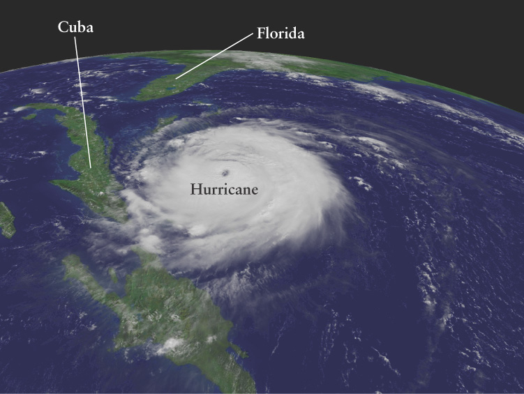
A Hurricane Seen from Space This image of Hurricane Frances was made on September 2, 2004, by GOES-12 (Geostationary Operational Environmental Satellite 12). A geostationary satellite like GOES-12 orbits around Earth’s equator every 24 hours, the same length of time it takes the planet to make a complete rotation. Hence, this satellite remains over the same spot on Earth, from which it can monitor the weather continuously. By tracking hurricanes from orbit, GOES-12 makes it much easier for meteorologists to give early warning of these immense storms. The resulting savings in lives and property more than pay for the cost of the satellite.
A Hurricane Seen from Space This image of Hurricane Frances was made on September 2, 2004, by GOES-12 (Geostationary Operational Environmental Satellite 12). A geostationary satellite like GOES-12 orbits around Earth’s equator every 24 hours, the same length of time it takes the planet to make a complete rotation. Hence, this satellite remains over the same spot on Earth, from which it can monitor the weather continuously. By tracking hurricanes from orbit, GOES-12 makes it much easier for meteorologists to give early warning of these immense storms. The resulting savings in lives and property more than pay for the cost of the satellite.
(NASA, NOAA)