Figure 11-17: R I V U X G
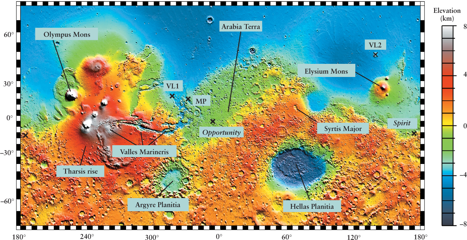
A Topographic Map of Mars This map was generated from measurements made by the laser altimeter on board the Mars Global Surveyor spacecraft. As in Figure 11-15, color indicates elevations above or below the planet’s average radius. Most of the southern hemisphere lies several kilometers above the northern hemisphere, with the exception of the immense impact feature called Hellas Planitia. The landing sites for Viking Landers 1 and 2 (VL1 and VL2), Mars Pathfinder (MP), and the Mars Exploration Rovers (Spirit and Opportunity) are each marked with an X.
A Topographic Map of Mars This map was generated from measurements made by the laser altimeter on board the Mars Global Surveyor spacecraft. As in Figure 11-15, color indicates elevations above or below the planet’s average radius. Most of the southern hemisphere lies several kilometers above the northern hemisphere, with the exception of the immense impact feature called Hellas Planitia. The landing sites for Viking Landers 1 and 2 (VL1 and VL2), Mars Pathfinder (MP), and the Mars Exploration Rovers (Spirit and Opportunity) are each marked with an X.
(MOLA Science Team, NASA/GSFC)