Figure 14-18: R I V U X G
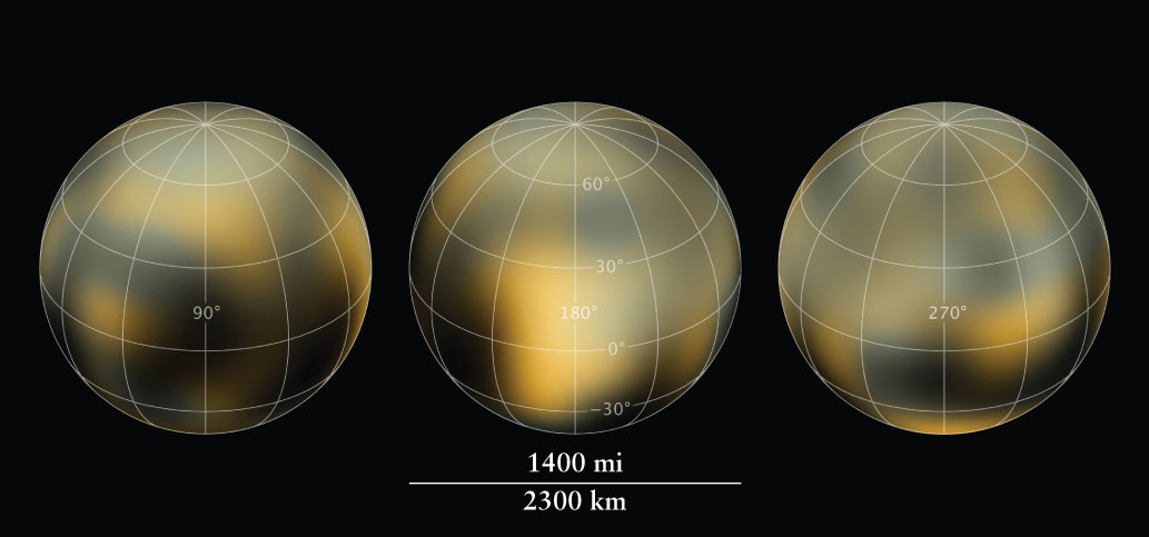
Three Faces of Pluto These real-color maps of Pluto were created using a technique called dithering. By comparing images taken at slightly different orientations, small changes in brightness can be traced back to spots on the surface that are too small to be directly resolved. To carry out this special analysis, it took 20 computers running continuously for four years to create these maps! The surface changes are thought to result from Pluto’s seasonal variation in sunlight exposure: As one region receives more light, ice evaporates and then refreezes onto colder regions.
Three Faces of Pluto These real-color maps of Pluto were created using a technique called dithering. By comparing images taken at slightly different orientations, small changes in brightness can be traced back to spots on the surface that are too small to be directly resolved. To carry out this special analysis, it took 20 computers running continuously for four years to create these maps! The surface changes are thought to result from Pluto’s seasonal variation in sunlight exposure: As one region receives more light, ice evaporates and then refreezes onto colder regions.
(NASA, ESA, and Z. Levay [STScI], and M. Buie [Southwest Research Institute])