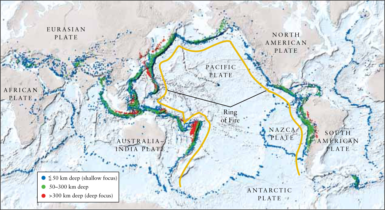
Figure 9-14: Earth’s Major Plates The boundaries of Earth’s major plates are the scenes of violent seismic and geologic activity. Most earthquakes occur where plates separate, collide, or rub together. Plate boundaries are therefore easily identified simply by plotting earthquake epicenters (shown here as dots) on a map. The colors of the dots indicate the depths at which the earthquakes originate. Typical speeds of plates are between 2 cm and 10 cm per year, where some separate from each other and some move closer together.
(Data from Harvard CMT catalog; plot by M. Boettcher and T. Jordan.)