How did Chesapeake tobacco society take shape?
Printed Page 61
CHRONOLOGY
1612
- – John Rolfe begins to plant tobacco in Virginia.
1617
- – Colonists send the first commercial tobacco shipment to England.
1619
- – First Africans arrive in Virginia.
1632
- – King Charles I grants land for the colony of Maryland.
1634
- – Colonists begin to arrive in Maryland.
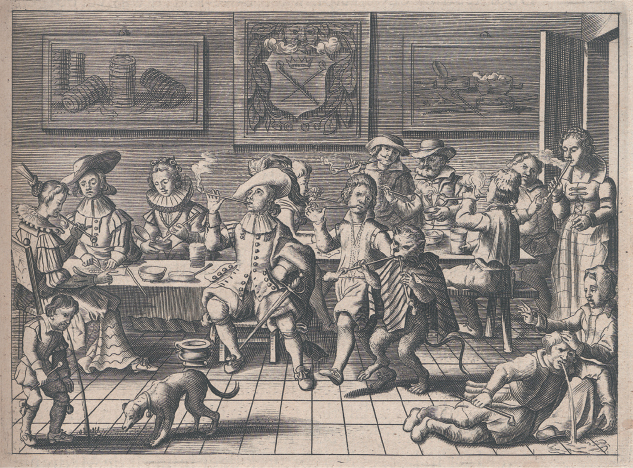
TOBACCO GREW WILD IN THE NEW WORLD, and Native Americans had used it for thousands of years before Europeans arrived. Many sixteenth-century European explorers noticed the Indians’ habit of “drinking smoke.” During the sixteenth century, tobacco was an expensive luxury used sparingly by a few in Europe. During the next century, English colonists in North America sent so much tobacco to European markets that it became an affordable indulgence used often by many people.
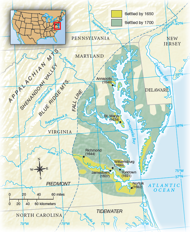
By 1700, nearly 100,000 colonists lived in the Chesapeake region, encompassing Virginia, Maryland, and northern North Carolina (Map 3.1). Although they differed in wealth, landholding, access to labor, and religion, they shared a dedication to growing tobacco. They exported more than 35 million pounds of tobacco in 1700, a fivefold increase in per capita production since 1620. Settlers lived by the rhythms of tobacco agriculture, and their endless need for labor attracted droves of English indentured servants to grueling work in tobacco fields.