Mapping the West: Europe and the Mediterranean, c. 1150
Printed Page 343
Important EventsMapping the West: Europe and the Mediterranean, c. 1150
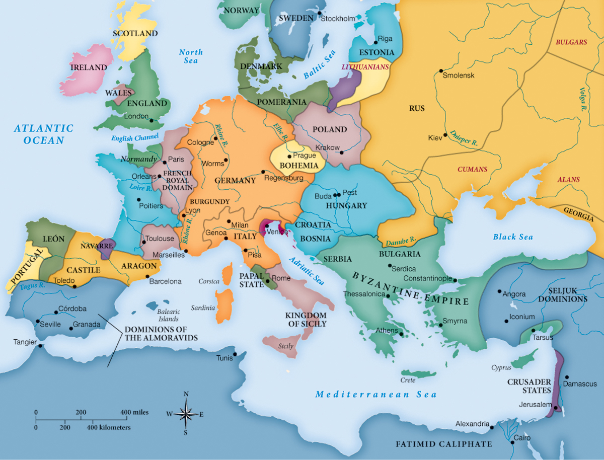
MAPPING THE WEST Europe and the Mediterranean, c. 1150
A comparison with Mapping the West in Chapter 9 reveals the major changes wrought during the century 1050–1150. England was politically tied to the continent with the Norman invasion of 1066. Soon the Seljuk Turks settled most of Anatolia, and the eastern wing of Byzantium was tightly wedged around Constantinople. At the end of the eleventh century, a narrow ribbon of crusader states was set up in the Holy Land. Meanwhile, Sicily and southern Italy came under Norman rule.
Analyzing the Map: What happened to the Byzantine Empire in the period 1050–1150?
Question
Analyzing the Map: What happened to the Byzantine Empire in the period 1050–1150?
accept_blank_answers: true
points: 10
Analyzing the Map: What happened to the Byzantine Empire in the period 1050–1150?
Making Connections: What explains the growth of the Northern kingdoms in Spain?
Question
Making Connections: What explains the growth of the Northern kingdoms in Spain?
accept_blank_answers: true
points: 10
Making Connections: What explains the growth of the Northern kingdoms in Spain?