343
- 5.1Area
- 5.2The Definite Integral
- 5.3The Fundamental Theorem of Calculus
- 5.4Properties of the Definite Integral
- 5.5The Indefinite Integral; Growth and Decay Models
- 5.6Method of Substitution; Newton's Law of Cooling
- Chapter Reveiw
- Chapter Project

Managing the Klamath River
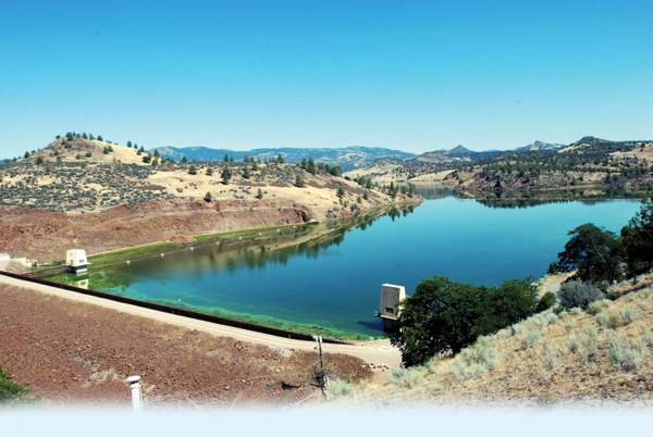
The Klamath River starts in the eastern lava plateaus of Oregon, passes through a farming region of that state, and then crosses northern California. Because it is the largest river in the region, runs through a variety of terrain, and has different land uses, it is important in a number of ways. Historically, the Klamath supported large salmon runs. It is used to irrigate agricultural lands, and to generate electric power for the region. Downstream, it runs through federal wild lands, and is used for fishing, rafting, and kayaking.
CHAPTER 5 PROJECT
The Chapter Project on page 403 examines ways to obtain the total flow over any period of time from data that provide flow rates.
If a river is to be well-managed for such a variety of uses, its flow must be understood. For that reason, the U.S. Geological Survey (USGS) maintains a number of gauges along the Klamath. These typically measure the depth of the river, which can then be expressed as a rate of flow in cubic feet per second (ft\(^{\scriptsize\hbox{3}}\!\)/s). In order to understand the river flow fully, we must be able to find the total amount of water that flows down the river over any period of time.

We began our study of calculus by asking two questions from geometry. The first, the tangent problem, “What is the slope of the tangent line to the graph of a function?” led to the derivative of a function.
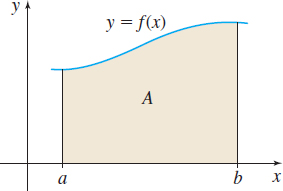
The second question was the area problem: Given a function \(f\), defined and nonnegative on a closed interval \([a,b]\), what is the area enclosed by the graph of \(f\), the \(x\)-axis, and the vertical lines \(x = a\) and \(x = b\)? Figure 1 illustrates this area.
The first two sections of Chapter 5 show how the concept of the integral evolves from the area problem. At first glance, the area problem and the tangent problem look quite dissimilar. However, much of calculus is built on a surprising relationship between the two problems and their associated concepts. This relationship is the basis for the Fundamental Theorem of Calculus, discussed in Section 5.3.